
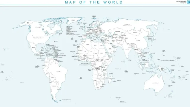
- New UN map shows Arunachal, Aksai Chin differently from India's claims.
- Arunachal depicted without Nagaland border; Aksai Chin shown separately.
- India supported UN resolution but asserts its territorial integrity.
A new United Nations world map has put Arunachal Pradesh and Aksai Chin back in the spotlight in India, after the two regions appeared on the map in a way that does not match New Delhi's official territorial claims.
The new map was published on July 1, 2026 which shows both Arunachal Pradesh and Aksai Chin as separate regions between competing Indian and Chinese boundary lines.
What does the map show?
In the case of Arunachal Pradesh, the map does not show a border with Nagaland. Instead, it depicts the region separately, with Assam to its south and China to its north.
Aksai Chin is also shown separately, with India on its western side and China on its eastern side. The United Nations has not explained why the two regions have been depicted this way.
The map also marks the Line of Control (LoC) between India and Pakistan in Jammu and Kashmir with a dotted line. In a footnote, the United Nations said the "dotted line represents approximately the LoC in Jammu and Kashmir agreed upon by India and Pakistan."
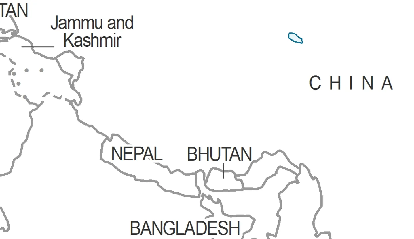
"The final status of Jammu and Kashmir has not yet been agreed upon by the parties," it said.
Why was the map issued?
The map was released in the backdrop of a United Nations General Assembly (UNGA) resolution titled "Correct the Map", which calls for a more accurate and equitable representation of the world's regions, particularly Africa.
The resolution was backed by India and supported by Togo on behalf of the African Group. It seeks to promote equal-area maps, which give continents a more proportionate representation of their actual size.
The resolution is non-binding. However, the map is expected to be adapted as a standard representation by multilateral institutions around the world.
The move has also faced criticism from the United States, which accused the United Nations of focusing on the issue while more pressing global challenges remain.
Where does India stand?
India supported the resolution with the Foreign Ministry clarifying that its vote was based on the "underlying principle of promoting equal-area cartographic representation."
"We also highlighted that the resolution does not constitute endorsement of any specific map, projection, or depiction of national boundaries," the Ministry said.
"India's sovereign territory, including the Union Territories of Jammu and Kashmir and Ladakh, must be depicted in accordance with India's official map. Any inaccurate or misleading depiction is unacceptable. Our position on India's sovereignty and territorial integrity is clear, consistent, and non-negotiable," it added.
MEA spokesperson Randhir Jaiswal said India voted in favour of the UNGA resolution and clarified that it supports the principle of equal-area maps, not any specific map issued by a private party or entity. The resolution aims to ensure maps accurately preserve the relative sizes of continents and major geographical features.
Recommended For You
#WATCH | Delhi: MEA Official Spokesperson Randhir Jaiswal said, “On your question about the UNGA resolution, when this resolution was adopted, we favoured the resolution and voted in favour of the resolution. When the resolution was adopted in the UN General Assembly, we also… pic.twitter.com/6iRqtqcq8j
— ANI (@ANI) September 8, 2026
India has consistently maintained that the entire Union Territory of Jammu and Kashmir and Ladakh, including Aksai Chin, "has been, is and will always be an integral and inalienable part of India." New Delhi also maintains that Arunachal Pradesh is an integral part of Indian territory.