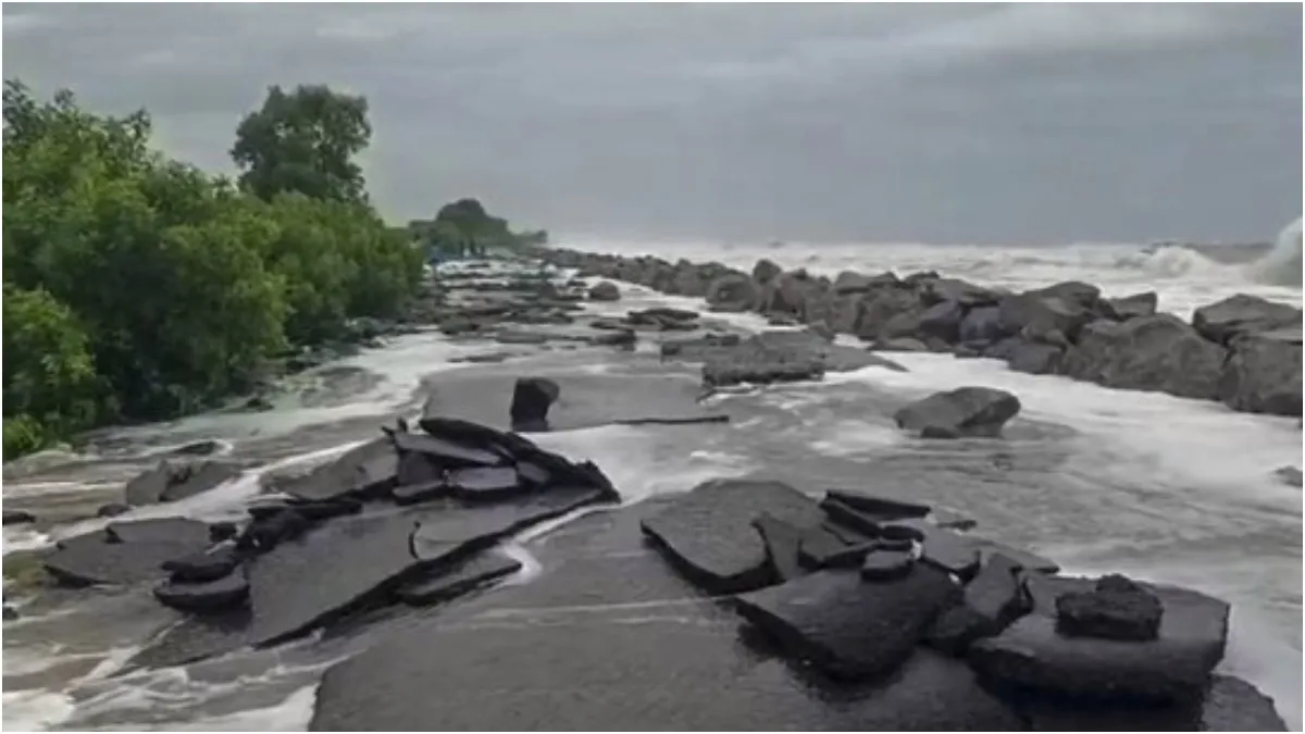
- Cyclone Murasu landfall completed in coastal Andhra Pradesh.
- Storm expected to weaken to cyclonic storm by noon.
- Heavy rains, strong winds, evacuations, no casualties reported.
Weather Cyclone Murasu Updates: Days after Cyclone Arnab hit India's eastern coast, Murasu, another cyclonic storm, originated in the Bay of Bengal and has crossed into coastal Andhra Pradesh. The landfall process started at 1 AM on Tuesday after wall clouds started to breach inside the coastal region between Nellore and Narsapur. The process completed in the morning and the IMD said it is likely to weaken from severe cyclonic storm to deep depression by the night.
According to the India Meteorological Department (IMD), the storm maintained a wind speed of 100-110 kmph gusting to 120 kmph. Rains started over the coastal regions of Tamil Nadu, Andhra Pradesh and Odisha since Monday evening, which intensified into heavy rains, accompanied by gale during landfall. Administration, along with rescue teams from NDRF and SDRF, remained on toes to assist those in needs. Mass evacuations drives were held to bring people to safety. So far no casualties have been reported.
Here are live updates
- NDRF DIG Mohsen Shahedi said that the wind speed declined and the worst-affected districts include, Prakasam, Krishna, Guntur and Nellore. "Look, the impact of Cyclone Morasu has been biggest in the coastal regions of Andhra Pradesh. At the time of landfall, its wind speed was approximately 100–110 kmph, with gusts reaching 120 kmph. The wind speed has now decreased, and according to the IMD report, the cyclone is expected to weaken into a cyclonic storm soon. By around 11:00–11:30 PM tonight, it is expected to further weaken into a deep depression. The worst-affected districts in Andhra Pradesh include Prakasam, Krishna, Guntur and Nellore, where very heavy rainfall has been reported. In view of the situation, the state administration has set up relief shelters, where approximately 10,000 people have been evacuated and accommodated. Medical camps have also been established. The situation is being closely monitored. As per the information available with us so far, there has been no loss of life."
Recommended For You
- NTR District Collector G Lakshmisha said that no untowards incident has taken place so far. The district is getting 2 mm rainfall every hour. "So far there has been no untoward incident. We are getting an average 1.52 or 2 millimeter rains average per hour. In last two hours only we got around 6 millimeter rainfall. So our entire district administration is prepared. The Budameru catchment area is being monitored and there is no imminent threat. All the road clearing and monitoring teams are deployed. The situation is not alarming. There are no major road blocks or disruptions. Everywhere things are normal. We will continue to monitor the situation for next 24 hour to 36 hours," he said.
- Several Trains were affected On Vijayawada-Ongole-Gudur section due to cyclonic storm. According to South Coast Railway, the train movement was temporarily suspended/regulated on the section due to incessant rainfall and high wind velocity. The trains diverted are:
- 12625 Thiruvananthapuram Central to New Delhi Kerala Express has been diverted to run in Renigunta-Yerraguntla-Nandyal-Guntur-Vijayawada route instead of Renigunta-Gudur-Vijayawada
- 22863 Howrah to Sir M Visvesvaraya Terminal Bengaluru Superfast Express has been diverted to travel on Guntur-Nandyal-Yerraguntla-Renigunta
- 04131 Kanpur Central to Sir M Visvesvaraya Terminal Bengaluru Special has been diverted to run in Guntur-Nandyal-Yerraguntla-Renigunta with no halts at Chirala, Ongole, Nellore.
- 18638 Sir M Visvesvaraya Terminal Bengaluru to Hatia Express has been diverted on the Renigunta-Yerraguntla-Nandyal-Guntur-Vijayawada section instead of Renigunta-Gudur-Vijayawada
- The IMD in its fresh update aid that the Severe Cyclonic Storm 'Murasu' over south coastal Andhra Pradesh moved north-northwestwards and lay centered near about 30 km north-northeast of Ongole, 40 km southwest of Bapatla (Andhra Pradesh), 90 km north-northeast of Kavali (Andhra Pradesh), 100 km south-southwest of Vijayawada (Andhra Pradesh) and 120 km west-southwest of Machilipatnam (Andhra Pradesh). The severe cyclonic storm will weaken gradually into a cyclonic storm (wind speed reaching 80-90 kmph gusting to 100 kmph) by noon and further into a deep depression (wind speed reaching 55-65 kmph gusting to 75 kmph) by midnight of today.
- Andhra Pradesh Chief Minister N Chandrababu Naidu expressed gratitude to Karnataka CM and people for their timely support in dealing with the impact of the severe cyclonic storm Murasu. "Heartfelt gratitude to Honourable Chief Minister of Karnataka, DK Shivakumar Garu, and the people of Karnataka for standing with Andhra Pradesh during Cyclone Murasau. Your timely support in our hour of need will never be forgotten," Naidu said in a post on X.
- The severe cyclonic storm Murasu has left a trail of destruction in Andhra Pradesh, uprooting thousands of trees, damaging hundreds of electric poles, and wrecking fishing boats. Standing crops suffered extensive damages due to heavy rains and gusty winds across several districts including Bapatla and Prakasam. Many places came under sheets of water.
Speaking about the horror, Krishnamma, fisherman from Kothapatnam in Prakasam district told PTI, "This is the most dangerous cyclone we have witnessed in the last 14 years. The government has been very helpful and evacuated around 400 families from our village. NDRF teams also helped us shift to safer places."
- A local resident said she had lost her house during an earlier cyclone, but this time the government evacuated them before the landfall. "I had lost my house in an earlier cyclone, and my family was also shattered. This time, the government evacuated us before the cyclone made the landfall. However, one of my three boats has been completely destroyed. Fishing is our livelihood," she said.
- Heavy rainfall and strong gale winds triggered rough sea conditions near Kothapatnam in Andhra Pradesh. The intense weather conditions causing damage to thatched houses and uprooted trees in the region.
- As per the India Meteorological Department (IMD), the coastal districts of Andhra Pradesh are likely to witness heavy rainfall for the next 12 hours. Along with heavy downpour, the regions are also set to receive thunderstorms and gusty winds.
- The heavy rainfall and strong winds caused waterlogging in Andhra Pradesh's Bapatla district. The NDRF personnel have been deployed to clear a fallen tree in the region.
#WATCH | Andhra Pradesh | Tree uprooted due strong winds and heavy rain as an impact of cyclone Murasu near Suryalanka Road in Bapatla; NDRF personnel clearing the fallen tree https://t.co/81lKVE8q6f
— ANI (@ANI) November 3, 2026
- Cyclone Mirasu has completed its landfall as its centre entered the land. IMD said that the severe cyclonic storm is likely to weaken into a cyclonci storm by noon and into a deep depression by midnight.
- Baptala in Andhra Pradesh is also witnessing heavy rainfall and string winds. Roads were waterlogged while trees were uprooted at many places. NDRF personnel deployed in the district were engaged in clearing the road by removing the fallen trees.
- In its latest update, IMD stated that Cyclone Murasu is likely to continue to move North-northwestwards and weaken gradually into a cyclonic storm (wind speed reaching 80-90 kmph gusting to 100 kmph) by noon and further into a deep depression (wind speed reaching 55-65 kmph gusting to 75 kmph) by midnight of today, the 3rd November,2026. It is under the continuous surveillance of Doppler Weather Radars at Machilipatnam and Visakhapatnam.
- In Ongole, several trees were uprooted while temporary structures collapsed due to heavy rainfall and gale gusting at 120 kmph. Visuals from the site show destruction.
VIDEO | Andhra Pradesh: Cyclone Murasu makes landfall. Heavy rainfall accompanied by gale winds batters Ongole. (Visuals from 6:10 am) #CycloneMurasu #AndhraPradeshNews (Full video available on PTI Videos - https://t.co/d8jp61yd2p) https://t.co/teP5AtEFNz
— Press Trust of India (@PTI_News) November 3, 2026
- Roads were inundated in Andhra Pradesh's Vijayawada due to heavy rains triggered by cyclonic storm. A video shared by news agency PTI shows buses traffic and people wading on the roads.
- Andhra Pradesh IMD chief K Nagaratha said that a storm surge of around 1 to 1.5 meters above the astronomical tide is likely to inundate low-lying areas of south coastal Andhra Pradesh through the morning of 3 November. The maximum peak surge is expected over the Bapatla region between the Krishna and Prakasam districts, after which it is expected to gradually decrease."
- Schools, colleges and Angwanwadi centres have been closed in several districts of Tamil Nadu, Andhra Pradesh and Odisha. NTR, Krishna, Guntur, Bapatla, Palnadu, Prakasam, Nelor, Markapuram, Chennai, Chengalpattu and Tiruvallur, among others.
- Providing update on Murasu, Director of the Andhra Pradesh IMD K Nagaratna said, "At present the severe cyclonic storm Murasu lies over 15.45 degrees latitude and 80.25 degrees east longitude and it's nearly 20 kilometers east southeast of Ongole, 60 kilometers south southwest of Bapatla and 70 kilometers north northeast of Kavalli and 100 kilometers around north northeast of Nellore and the landfall process that is already happening near to Ongole is likely to continue for next 1 to 2 hours and this gale winds associated at present with this system are continuing to be 100 to 110 kilometers per hour at times 120 kilometers per hour... In association with the severe cyclonic storm, there is likely of heavy rainfalls occurring in the coastal Andhra Pradesh, south coastal Andhra Pradesh... Red warnings have been issued to Krishna, Guntur, Bapatla, Palnadu, NTR, and Prakasam... Fishermen are advised not to venture into the sea even on today till 4th November morning and there is total suspension of offshore and onshore operations till the operations are reviewed as per the warnings of IMD. It is better to follow IMD updates and further advices till the cyclonic storm has been weakened."
- Rough sea conditions were witnessed off Chennai coast on Tuesday morning after 'severe' Cyclone Murasu started its landfall in south coastal Andhra Pradesh. Similar scenes surfaced from Puducherry as the entire region saw heavy rainfall. Visuals from Marina Beach sho fishermen venturing in the sea.
#WATCH | Chennai, Tamil Nadu: The Severe Cyclonic Storm Murasu crossed the South Andhra Pradesh coast between Nellore and Narsapur, close to Ongole, between 0330 and 0530 hours IST today, with wind speeds of 100-110 kmph, gusting to 120 kmph. Visuals are from Marina Beach shows fishermen venturing into the sea.
— ANI (@ANI) November 3, 2026
- Many families were shifted to relief campos in Andhra Pradesh's NTR district. Collector Lakshmisha said that there were no major issues in the district so far due to the cyclonic storm. He urged people to remain indoors given the forecast for heavy to very heavy rainfall. He said that several families were shifted to relief camps as a precautionary measure in view of possible landslides in Mogalrajapuram.
- Andhra's coastline is witnessing intense rainfall along with strong winds. Kothapatnam Beach area near Ongole is witnessing heavy rainfall.
#WATCH | Ongole, Andhra Pradesh: The landfall process of Cyclone Murasu has started along the South Andhra Pradesh coast. Heavy rainfall accompanied by extremely strong gale winds is lashing the Kothapatnam Beach area near Ongole, with strong winds witnessed along the coastline as the cyclone makes landfall.
— ANI (@ANI) November 3, 2026
- Reports of uprooted trees also emerged in several parts of the state. Several trees were uprootes in Chirala region after landfall commenced.
- The South Coastal Railways (SCoR) has cancelled 9 trains as a precautionary measure for Cyclone Murasu. These trains include:
- 67225 Vijayawada–Gudur Passenger departing Vijayawada on November 2
- 12744 Vijayawada–Gudur Express departing Vijayawada on November 2
- 67235 Guntur–Tenali Passenger departing Guntur on November 2
- 67237 Tenali–Repalle Passenger departing Tenali on November 2
- 67226 Gudur–Vijayawada Passenger departing Gudur on November 3
- 12743 Gudur–Vijayawada Express departing Gudur on November 3
- 67236 Tenali–Guntur Passenger departing Tenali on November 3
- 67238 Repalle–Markapur Passenger departing Repalle on November 3
- 67239 Markapur–Tenali Passenger departing from Markapur on Nov 3
- So far, at least 19 domestic flights have been cancelled at Vijayawada, Tirupati and Visakhapatnam airports. Over 2 lakh people were evacuated in Andhra Pradesh and Odisha and moved to safer locations while disaster relief teams, including the NDRF, on alert.